
MARS ORBITING LASER ALTIMETER
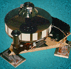
One of the top objectives for Mars exploration since the Viking mission has been the mapping of the planet's topography, or the elevation of its surface. The instrument chosen to address this objective on Mars Global Surveyor (MGS) is the Mars Orbiting Laser Altimeter, or MOLA.
MOLA is the first of a new generation of orbital laser altimeters. It was first built for the Mars Observer mission, and instruments with similar designs have since been flown on the Clementine mission to the Moon and planned for missions both in Earth orbit (on the space shuttle) and to other bodies in the solar system (such as Mercury and an asteroid). The measurements made by this instrument will contribute immensely to our understanding of Mars.

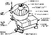
The basic principles behind its operation are simple. A very short burst of light (about eight billionths of a second long) is shot from the laser toward the surface of the planet. At the same time, an extremely accurate timer starts counting. The pulse is reflected from the planet, and this very weak reflected light is collected by a half-meter (20 inch) diameter telescope on the spacecraft about two thousandths of a second later. When the telescope's detector senses the arrival of the returned beam, the timer is stopped. The distance from the spacecraft to the surface (or range) is then simply one-half the round trip travel time of the pulse divided by the speed of light. The timing within this instrument is accurate enough to resolve difference in range of less than 1 meter! This operation is done ten times a second, and the motion of the spacecraft over the surface results in a line of measurements that circles the globe as the orbit progresses.
Of course the details of carrying out this procedure can get quite complicated. For example, if the ground is not perfectly flat, the light that reflects from the high spots will arrive slightly before the light that reflects from the low spots. This would not be a problem if the beam remained its initial size (about the diameter of a soda straw), as the variation in height would be much less than the precision of the measurement. But by the time it has traveled the roughly 400 kilometers (about 240 miles) to the surface, it illuminates a spot about the size of two side-by-side football fields. Large variations in elevation across this "footprint" results in a phenomenon called "pulse broadening", in which the initially short pulse that was sent down comes back much more stretched out in time. This makes it harder to detect the signal above the background infrared noise, since the energy is spread over a longer time, and it is also more difficult to decide exactly where in this long pulse the actual "arrival" is. For this reason, MOLA employs four separate detector channels that are optimized for different pulse widths. This increases the probability that the returned pulse will be detected even over regions with steep terrain. This technique also may allow the detection of diffuse reflections from the tops of ground fogs such as were seen in some Viking Orbiter images.
Even though the range is measured extremely accurately, there is still a much larger uncertainty in the elevation. This is because the elevation is defined as the distance of the surface above or below a reference that is fixed to the planet (sea level on the Earth, and an equivalent imaginary surface on Mars defined by its gravity field), but the range is measured with respect to the spacecraft position. So in order to calculate the elevation, one must first determine the spacecraft's orbital position very accurately. This is a difficult task, but techniques of spacecraft navigation using the ranging and Doppler velocity determination capability of the Deep Space Network tracking system should allow the position of the spacecraft with respect to the center of Mars to be determined to an accuracy of better than 30 meters (100 feet).

In order to save cost, MOLA has borrowed designs and technology from several earlier programs. It uses an infrared laser derived from technology developed for military applications by the SDI program. These are not the "killer" lasers of course, but rather very small devices developed for determining the range to targets. The actual amount of power in the laser beam is only about a fiftieth of that in your refrigerator light. This laser uses solid-state diodes for its initial light source, giving it a much longer lifetime than earlier pulsed lasers, which used relatively short-lived flash lamps. With this technology, laser lifetimes of over a billion shots are now achievable, making possible operation over the entire two-year mapping mission envisioned for MGS. The telescope of the original MOLA built for Mars Observer was a spare unit from the Voyager IRIS instrument. When the instrument was rebuilt for MGS, it was necessary to find another source. It turned out that the Cassini project was building an instrument that uses a telescope with very nearly the same specifications, so MOLA was able to adopt their design with a minimum of modification.
Why is measuring topography such an important goal? There are a number of reasons, and they come from many different scientific disciplines. To get an idea of the magnitude of the advance that we are anticipating, consider that the current knowledge of topography on Mars is uncertain by as much as 3 kilometers, compared to the 30-meter accuracy expected from MOLA. Thus we should see a hundred-fold improvement in our knowledge of heights on Mars.
One of the basic uses of topographic information is in the construction of accurate maps which can be used both for scientific research and for mission planning of future landings on Mars. When a camera records an image, the apparent horizontal locations of features within that image are distorted by elevation variations (unless the camera is pointed precisely vertically). These distortions can easily be removed if the topography is known. And of course it helps to know when a lander can expect to meet the surface with an uncertainty of less than a few miles!
The detailed analysis of the three-dimensional shapes of geologic features can yield a greater understanding of the processes that formed and later modified them. Volcanic slopes and volumes reflect the viscosity of the lavas from which they formed (which is related to their temperature and composition) and the speeds with which they erupted. The depths of craters and the heights of their rims provide insight into the mechanics of crater formation and the strength of crustal materials.
Weather patterns are strongly affected by elevation on Mars. Regions of elevated topography affect atmospheric circulation by acting as barriers to flow and by affecting the thermal budget of the surface. Mars global circulation models, which will help us to understand the basic atmospheric processes that drive the weather on Earth as well as on Mars, require an accurate global map of the topography in order to be fully utilized.
The density and structure of planetary interiors provide information on the basic processes of planetary formation and evolution. The most powerful tool we now have for exploring the interior of a planet from orbit is analysis of the fluctuations in the gravity field which originate from density variations below the surface. But in order to identify the effects of deep structure, it is necessary first to remove the gravity effects due to the topography itself, which is often the strongest single contributor to the field. Topography also reflects the response of the crust to forces within the planet, which can offer important clues to the origins of those forces and the mechanical properties of the outer layers of the planet. The thickness of the crust itself can most easily be determined from an analysis of the ratio of gravity to topography.
Topography figures into many of the fundamental questions we are trying to answer about the history of Mars and about the processes that are active on it today. MOLA will finally bring our quantitative knowledge of topography to a level at which we can begin to address these questions. By applying insight gained at Mars to the similar processes occurring on Earth, we will be able to better understand our own planet.
--Bruce Banerdt


