
 Mariner 4,JPL-P-4732
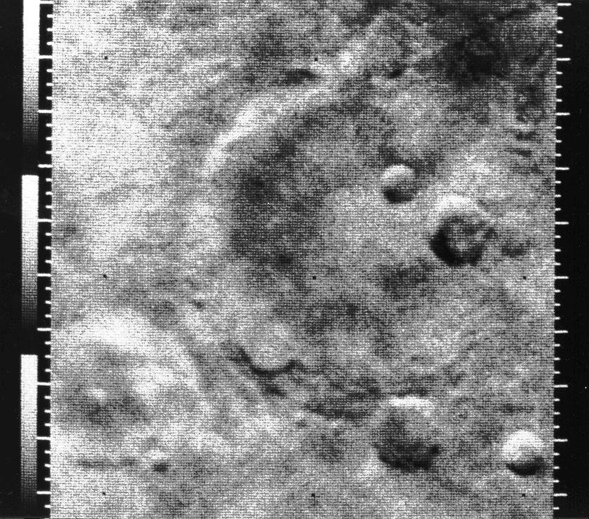 Mariner 4 image, JPL-7875A
 The next glimpse of the Red Planet came from Mariner 6, which flew by the Mars equator on July 30, 1969, and from Mariner 7, which passed by the Martian southern hemisphere on August 4, 1969. Both of these missions were able to get closer to the planet than Mariner 4. Mariner 6 and 7 returned 75 and 126 pictures (respectively) to JPL. The pictures were taken from just over 3256 km (2000 miles) away. Because new advances in telecommunications provided a sixty-fold increase in the data transmission rate, these spacecraft were able to yield many more pictures than the first mission. But the new pictures just raised more questions in the mind of scientists, and increased their desire to land a data-gathering spacecraft on the surface of Mars.
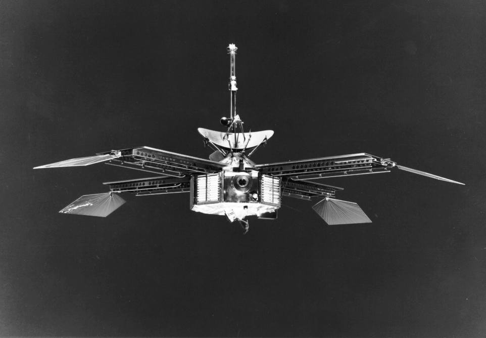
 Mariner 6 and 7 spacecraft, JPL-P-9141A
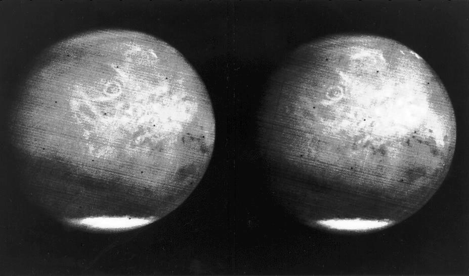 Mariner 7 photo showing Olympus Mons JPL-P-10276
 Mariner 9 was the first orbiter of Mars designed with the specific purpose of identifying potential sites for a future Viking spacecraft lander. Mariner 9 entered Mars orbit on November 13, 1971 and transmitted back to JPL a whopping 7329 pictures taken only 1390 km (862 miles) from the planet itself. Among these were the first pictures of the surface of Mars' two moons, Deimos and Phobos.
 Mariner 9, JPL-P-12035
 Olympus Mons.JPL-P-13074
From the Mariner 9 mission data, landing sites were picked for Vikings 1 and 2. These two identical spacecraft each consisted of a lander and an orbiter. Viking 1 was launched on August 20, 1975 and Viking 2 was sent up on September 9, 1975. The first landing ever to be accomplished on the surface of Mars was accomplished when the Viking lander set down on July 20, 1976 on Chryse Planitia (The Plains of Gold). The Viking 2 lander followed on September 3, 1976, touching down at Utopia Planita. The landers transmitted data back to JPL far beyond their expected life. Viking Lander 1 ended transmissions in 1982, while Lander 2 stopped in 1980. The Viking Orbiters also produced beyond their planned mission life, with Orbiter 1 ending transmissions in 1980 and Orbiter 2 ceasing in 1978. The landers sent back to Earth over 4500 pictures and the orbiters returned over 52,000 photographs. Our current knowledge of Mars is primarily derived from this Viking data.
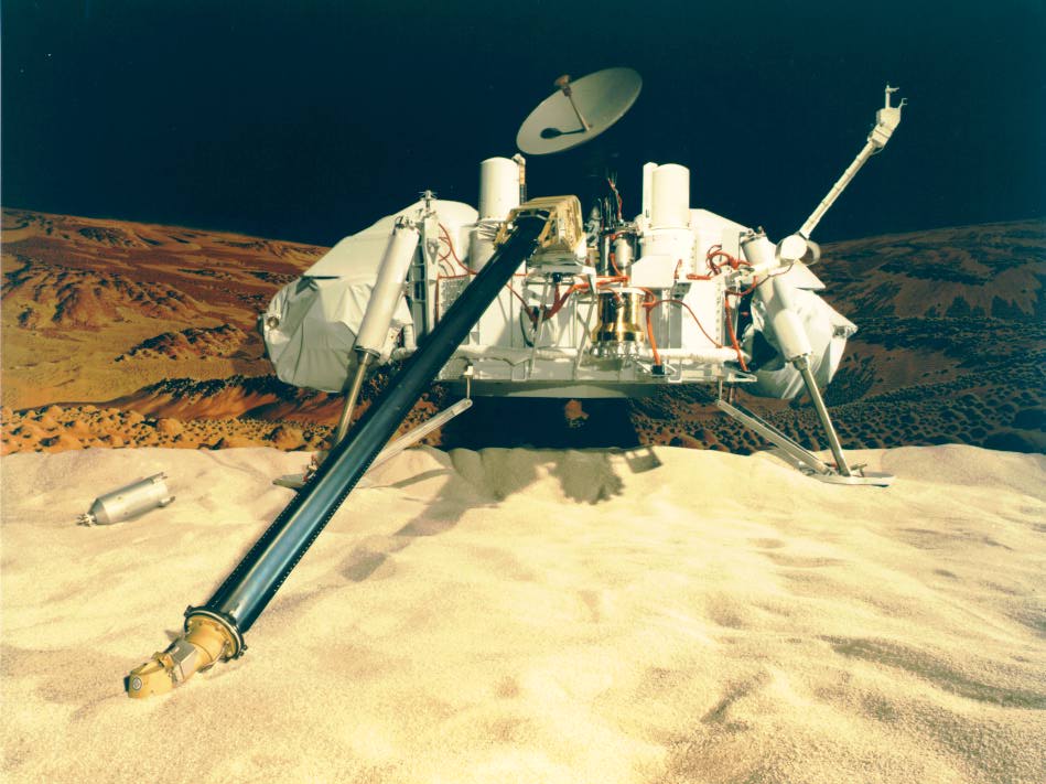 Model of Viking Lander JPL-P-16105
 Viking 1/Titan Centaur 3 JPL-P-293-9156
 The two Viking landers continuously monitored weather at their respective landing sites, and reported on Martian temperatures, barometric pressure, and wind conditions. The Viking spacecraft gave us good information about the Martian terrain by mapping about 97% of the planet's surface. Viking data also determined that the planet's north polar ice cap is made of water ice rather than frozen carbon dioxide, as had been previously thought. The mission data led scientists to conclude that the northern and southern hemispheres are very different climatically, and that subsurface water in the form of permafrost covers most, if not all, of the planet.
These and other discoveries of the Viking and Mariner missions have only served to whet the appetites of all of us to further explore the Red Planet. These past missions have given us a fascinating scrapbook of our neighboring planet.
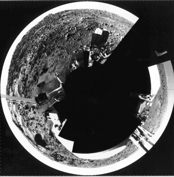 Computer generated "fisheye" mosaic of Viking 1 Lander. JPL-P-19533B
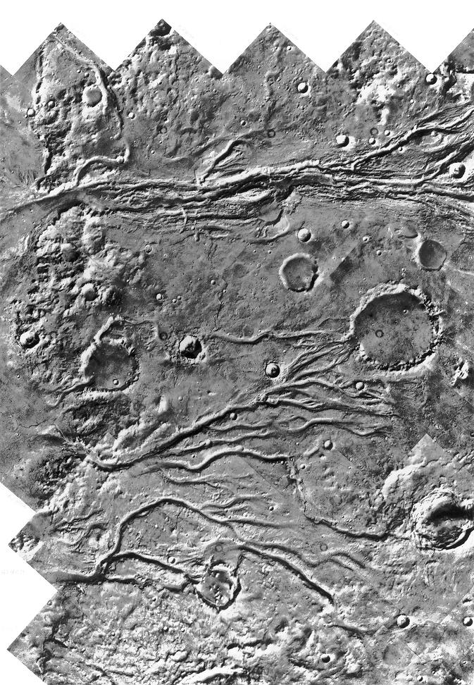 Viking Orbiter 1 mosaic of the Mars surface. JPL-P-17698
 Viking Orbiter 1 image of Olympus Mons JPL-P-17444
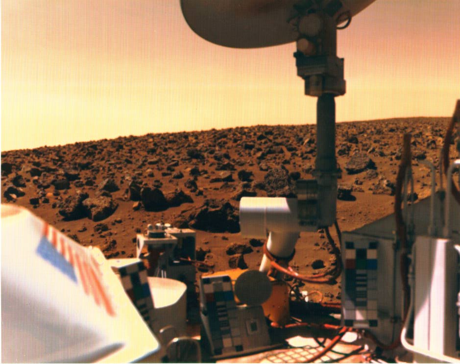 Mars surface image. JPL-P-18296
 Last photograph from Viking Lander1 JPL-P-22668
 First picture from Viking 2. JPL-P-17681
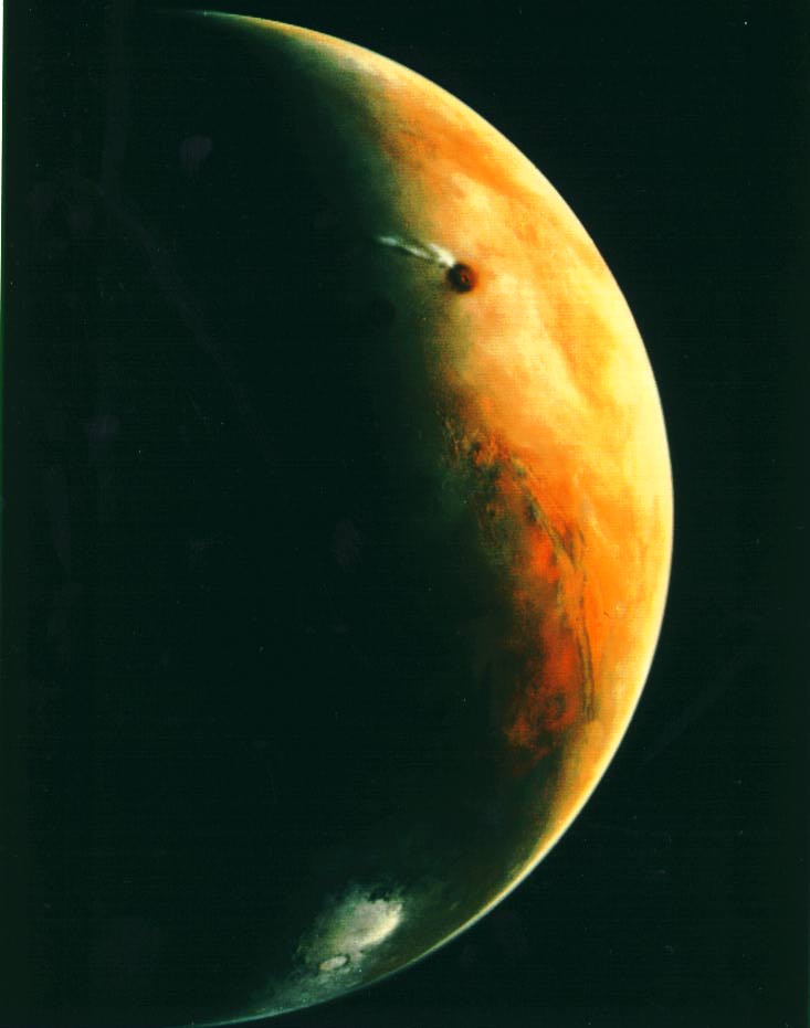 Taken by Viking Orbiter 2 JPL-P-19009
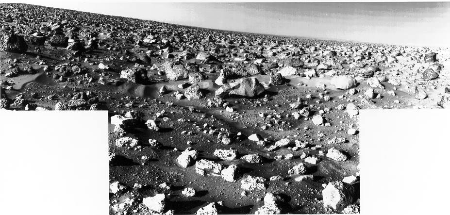 Two mosaiced scans JPL-P-17689
 Operation of the surface sampler. JPL-P-18066