Press Conference Day
Dr. Wes Ward
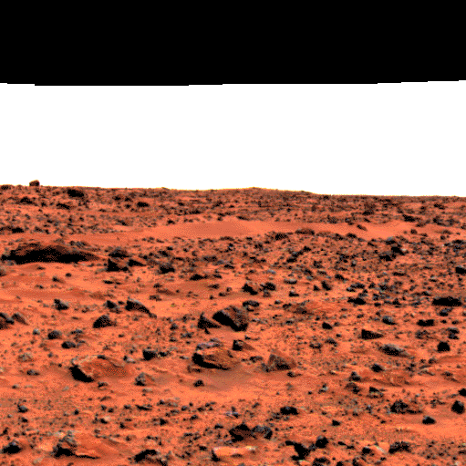
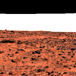
 Ward_drift.jpg
 |
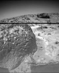
This image is of so-called wind drifts seen at the Viking 1 landing site.
These are somewhat different from the features seen at the Pathfinder site
in two important ways.
- These landforms have no apparent slip- or avalanche-face as do both
terrestrial dunes and the Pathfinder features, and may represent deposits
of sediment falling from the air, as opposed to dune sand, which "hops"
or saltates along the ground;
- these features may indicate erosion on one side, because of the layering
and apparent scouring on their right sides. They may, therefore have been
deposited by a wind moving left to right, partly or weakly cemented or
solidified by surface processes at some later time, then eroded by a second
wind (right to left), exposing their internal structure.
|
 Roadrunner_Flats.gif
 |
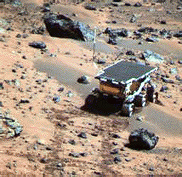
| This enhanced color image of the Pathfinder landing site shows the eastern
horizon. The elongated, reddish, low contrast region in the distance is
"Roadrunner Flats.". |
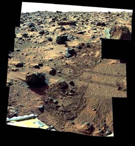 BarnacleBill.jpg
 |
| This is an image from the super-pan sequence. Of importance are some of
the features around the rock nicknamed Barnacle Bill in the left foreground.
The rock shows a "streamlined tail" composed of particles deposited
by wind on the leeward (downwind) side of the rock. Also seen is a "moat"
around the opposite (windward) side of the rock where either erosion (or
non-deposition) of fine sediment has occurred. Mars Pathfinder scientist
believe that the wind blowing over and around rocks like Barnacle Bill creates
an airflow pattern wherein a buffer zone is formed immediately upwind of
the rock and airflow patterns keep sediment from being deposited directly
upwind of Barnacle Bill. On the downwind side, however, the airflow is complex
and a small wake and tapered "dead air zone" form. Sediment can
be deposited within this region, the shape of the formed deposit corresponds
to the airflow patterns that exist behind the rock. Similar features have
been observed at the Viking landing sites, and are thought to form under
high wind conditions during the autumn and winter seasons in the northern
hemisphere. This image mosaic was processed by the U.S. Geological Survey
in support of the NASA/JPL Mars Pathfinder Mars Mission. |
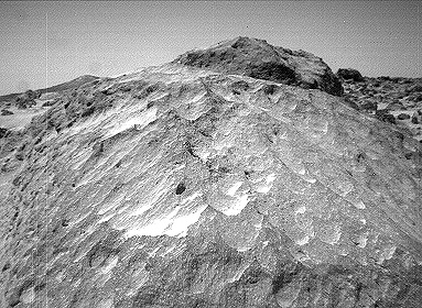
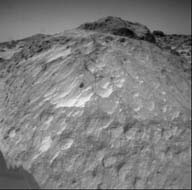 Moe_left.jpg
 |
| A close-up view of the rock "Moe" in the Rock Garden at the Pathfinder
landing site. Moe is a meter-size boulder that, as seen from Sojourner,
has a relatively smooth yet pitted texture upon close examination. Such
a texture is seen on Earth on rocks that have been abraded by wind in a
process that is analogous to sand blasting. This view of Moe shows two faces
on the rock, one (left side of the rock) facing north-northeast and the
other (right side) facing east. These two faces are thought to have been
pitted and fluted by strong, "sand"-carrying winds from the northeast. |
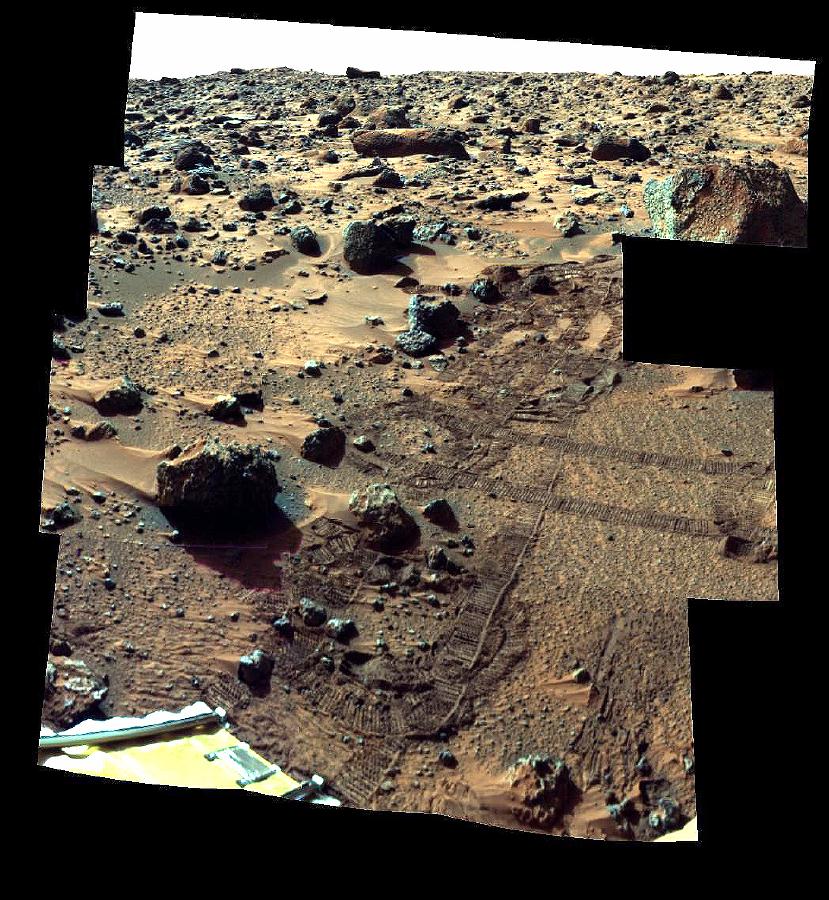
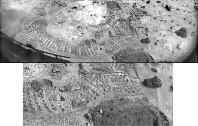 RF29066.jpg
 |
| This pair of images shows a broad view (upper image) and detailed close-up
view (lower image) of the disturbed surface near and on Mermaid Dune. Seen
slightly right of center in the upper image are two diggings by the rover's
wheel. The uppermost rut is in the surface away from Mermaid and is considered
to be typical of the surface at the landing site. The closer rut represents
the surface at the base of Mermaid on the upwind side. The lower image is
an enlargement of the disturbed Mermaid sediments plus those of the underlying
substrate; that is, the ground upon which the dune lies. Seen in the close-up
are at least two types of sediment, one that seems to be approximately 1.4
cm thick and forms piles with sides sloping at approximately 35 degrees,
and another at least 3 cm deep composed of sediment that has a characteristic
slope of 41 degrees when piled. It is apparent in the images that there
is a size range of sediment present in the rut, sediment that ranges from
a few millimeters in size down to below the resolution of the camera. |
 rover_Mermaid_Dune.jpg
 |
| This is an image of the rover Sojourner at the feature called Mermaid Dune
at the MPF landing site. Mermaid is thought to be a low, transverse dune
ridge, with its long (approximately 2 meter-) axis transverse to the wind,
which is thought to come from the lower left of the image and blow toward
the upper right. The rover is facing to the lower left, the "upwind"
direction. The rover's middle wheels are at the crestline of the small dune,
and the rear wheels are on the lee side of the feature. A soil mechanics
experiment was performed to dig into the dune and examine the sediments
exposed. |
 Stimpy_left.jpg
 |
| The rock "Stimpy" is seen in this close-up image taken by the
Sojourner rover's left front camera on Sol 70 (September 13). Detailed texture
on the rock, such as pits and flutes, are clearly visible. |
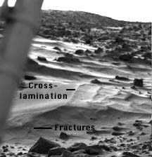
 TwinPeaks_right.jpg
 |
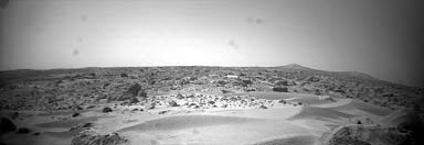
| This image was taken by the Sojourner rover in the area behind the "Rock
Garden" at the Pathfinder landing site and gives a view of the Martian
surface not seen from the lander. Of note here are several dune-like ridges
in the foreground. These features are less than a meter high but several
meters wide. They are thought to be created by surface winds blowing right
to left (approximately northeast to southwest). These features are called
dunes, because of their asymmetry, although the rover has not examined the
sediment within them. Such sediment on Earth would be sand-size grains less
than 1 millimeter in diameter. |
 windtail_vectors.jpg
 |
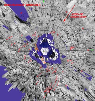
| This is a representation of sediment tails noted at the Mars Pathfinder
landing site. The arrows in the figure represent the inferred downwind direction,
based on our understanding of the deposition of very fine sediment around
surface rocks. The inferred wind direction therefore, is from the northeast
blowing toward the southwest. This wind trend matched that of light and
dark "streaks" of sediment in and around Martian craters in the
region that have were seen by the Viking spacecraft. The detailed map was
prepared by Mars Pathfinder scientists from Arizona State University on
a base image created by MPF scientists from the NASA Ames research facility. |
|